AIS is the backbone of offshore navigation. And soon, it becomes a valuable core layer of the NeuWave infrastructure.
Every offshore project depends on vessel movements but as projects scale, so does the need for sharper, more reliable fleet visibility. As offshore wind zones grow busier, vessel coordination is becoming more complex, more time-sensitive, and more dependent on accurate situational awareness.
By blending AIS with our high-resolution environmental models, we’re creating a smarter, more connected operational picture for offshore teams.
With NeuWave’s first AIS release – expected to land at the end of Q1 – here’s a bit of background, and exactly what you can expect from our next feature rollout.
Turn vessel tracking into actionable intelligence…
NeuWave transforms raw AIS signals into meaningful insights. Explore how live positions, forecast windows, and site-specific risk zones can help you to plan smarter and operate with greater confidence offshore.
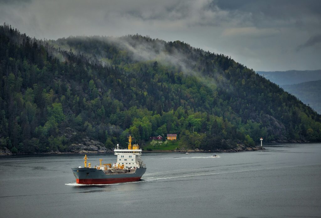
What is AIS tracking and what’s it used for?
In the most simple terms possible, Automated Identification Systems (AIS) are basically GPS for boats. Think Google Maps, but on the open water.
They are automated, autonomous tracking systems used extensively across global maritime operations. Precise location information is transferred electronically between autonomous AIS-equipped stations or terminals (that could be aboard vessels, back on-shore at ports or data centres, and satellites).
Since the early 21st century, AIS tracking has been mandatory for many large cargo and passenger vessels; and there’s a plethora of public AIS data available.
This has come under some scrutiny, however, with some calling for the privatisation of available data to protect perceived maritime security interests. AIS regularly transmits key details, including a vessel’s name, source, destination, and cargo; as well as dynamic data such as position and speed.
Despite being initially developed to help avoid collisions and control marine traffic flow, there is a wide range of potential uses for AIS navigation data.
Why is AIS an essential NeuWave feature?
Accurate and precise vessel positioning is the backbone of safe, efficient offshore operations. AIS gives project teams the live situational awareness that’s needed to coordinate operations and carry out projects in complex environments with confidence.
When combined with NeuWave’s high-resolution metocean models, AIS elevates planning, communications, and real-time decision making across the entire project lifecycle.
Let’s take a look at some of the specific benefits.
1. Enhanced safety
AIS affords project coordinators the real-time picture of all movements on site. It was originally designed for collision avoidance, and that purpose holds strong. On multi-vessel projects, where CTVs, SOVs, construction vessels, and guard ships might share confined work zones, AIS helps teams anticipate conflicts or collisions early and act proactively.
Layering AIS onto NeuWave’s environmental data adds a deeper level of safety insight, enabling teams to identify when environmental conditions combined with vessel trajectories could create risk and to intervene before those risks escalate.
2. Traffic management
Ports and offshore logistics hubs rely on AIS to maintain orderly traffic flows.
For offshore wind projects, where vessels are constantly transferring crews, equipment, assets, and components, AIS supports project-wide coordination and reduces operational bottlenecks. It enables smoother scheduling and clearer communication between vessels and assets, even when this involves multiple contractors or larger fleets.
On the NeuWave platform, AIS data becomes even more actionable; movements can be understood in the context of live conditions and forecast windows.
3. Operational intelligence
AIS is digital, and this makes it a powerful dataset for performance optimisation. Route refinement, fuel efficiency studies, transit benchmarking, activity mapping, and spatial risk analysis all become possible with robust AIS data archives.
AIS, when integrated into NeuWave, helps users understand operational behaviours, refine strategies, and validate planning assumptions based on both historical trends and live data updates.
4. Scalability and future-proofing
AIS also supports NeuWave’s vision for scalable, modular fleet intelligence.
As the tech improves, and more operators adopt private AIS transponders, AIS becomes a foundation for autonomous workflows and navigation. For NeuWave customers, it’s an essential step toward a smarter, more connected offshore environment.
Developing AIS – challenges and triumphs for the team
Building AIS capability into NeuWave infrastructure hasn’t been an overnight job, and we wanted to include some transparency here. Machine learning and product development isn’t always linear!
One of the early challenges was dealing with the limitations of VHF-based broadcasting. Traditional AIS signals typically reach around 20 nautical miles from the coast, which restricts visibility for offshore wind zones located farther out.
To bridge this gap, the team developed a hybrid approach, combining public AIS feeds with satellite-AIS sources. This creates far greater coverage and gives users consistent visibility even when vessels operate well beyond terrestrial range.
Another challenge lies in message precision. AIS static data (such as vessel name, weight, or destination) depends entirely on crew inputs. Errors are common and can coalesce into inaccurate visualisations if not handled correctly. That’s no use to our users aboard or onshore.
To solve this, NeuWave’s engineers are working on building validation and filtering logic that flags inconsistencies, reduces noise, and ensures only reliable information reaches the user interface.
AIS events can generate vast volumes of data, especially when global feeds are involved, so performance at scale was another focus. The team has invested heavily in compressing, batching, and optimising message handling so the platform remains fast and responsive, even when tracking higher numbers of vessels across wider site limits.
Ultimately though, some of the biggest wins have been user-experience driven. The product team refined map styling and created intuitive visuals, so project coordinators can focus on what matters most: the live operational picture.
What will NeuWave’s AIS tracking features look like?
NeuWave’s AIS features will incorporate live locations with our industry leading, high-resolution environmental data.
The NeuWave platform clearly displays relevant “safe” and “dangerous” work zones within your mapped site area (you can find these on the interactive map). New AIS features give users the ability to track their vessels directly.
Our data already supports decisions that can be made months advance. But AIS tracking means more data gathered in real-time, at your exact fleet positions and relevant areas.
We have also been working behind-the-scenes on satellite data inclusion, making NeuWave tools more accurate than ever before. While satellite data can’t always provide the same nearshore resolution as buoys, it is wider-reaching. The two together are a powerful combination of environmental insight for offshore operations.
Deeper insight into the reality of your offshore project. High-resolution environmental insights made visually accessible… That’s NeuWave’s USP.
With the introduction of AIS tracking and new satellite data, coordinators will be able to see what’s happening en-route and in real-time, allowing for unprecedented confidence in communications, dynamic navigation, and adaptable fleet management.
When can you expect AIS tracking on your NeuWave platform?
NeuWave AIS tracking features will begin rolling out with public AIS data, giving you instant visibility of any vessel broadcasting its position worldwide. From there, we’re introducing the ability for users to add their own AIS transponders, enabling fully project-specific fleet visibility. This phased approach moves us toward complete operational awareness across your site.
The first release is scheduled for End of Q1. Stay tuned on LinkedIn or the NeuWave blog for the next wave of updates!
AIS takes NeuWave’s operational intelligence to the next level.
It brings clarity to vessel movements and adds a powerful new layer to our real-time environmental insights. With AIS tracking on the horizon, NeuWave is expanding from environmental intelligence into full-scope operational visibility.
Our first release arrives at the end of Q1, supported by satellite integration and future private-transponder capabilities. Together, they’ll give users unprecedented insight into their fleet and wider operational environment, all within one intuitive platform.
Build a clearer picture of your offshore site…
Combine AIS, hindcast modelling, and high-resolution weather data inside one platform. NeuWave gives teams the accuracy needed to coordinate vessels, streamline logistics, and reduce downtime across every project phase.